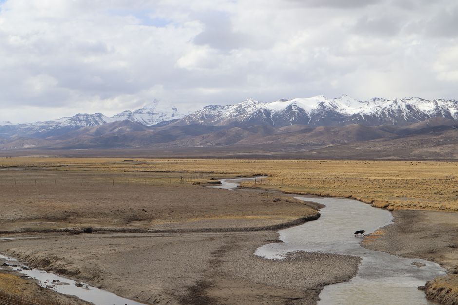
The event
A magnitude 7.0 earthquake struck northern Tibet near Nagqu on 22 October 2026, local time. China's earthquake agency (CENC) and the US Geological Survey are both reported to have put the magnitude at 7.0; those figures reach this article through Wikipedia's event page and a Reuters relay, and the primary bulletins were not opened. The depth is where the reporting breaks apart. India's National Center for Seismology (NCS) gives 173 km, CENC gives 10 km, and later revisions settle near 18 km.
Local time is also reported two ways. Wikipedia gives an origin time of 22:33:39 China Standard Time, while the Reuters relay describes the quake as occurring at about 10:33 p.m. local time. The two agree on the evening and the clock reading, but the Wikipedia figure has not been checked against CENC or USGS.
Plataforma Media, dated 23 October 2026, is the most recent report reviewed, and it said no casualty or damage reports had yet emerged. The sources are mostly wire, syndicated and aggregator reports, so this is an account of what has been relayed, not of what the agencies have published.
Why the depth figures disagree
The 18 km figure is secondhand. VolcanoDiscovery, an aggregator, lists the event at 18 km with USGS as its primary data source, after revisions on 22 October that included a change from 35 km to 24 km. The Wikipedia event page also gives 18 km. Neither the USGS event page nor any other USGS record was checked for this article, so the 18 km value cannot be confirmed at its origin, and it is unclear whether the two share a single source.
The 173 km figure comes from NCS. The Hans India and Daily Jagran carried it, the latter quoting an NCS post. No other agency in the reports reviewed gives that depth.
The shallower readings cluster together. A Reuters wire report, relaying CENC, gives 10 km, and a syndicated Newsdrum article says the same. A Bombay Samachar report says GFZ, the German Research Centre for Geosciences, also reported 10 km, citing CENC's figure. Newsdrum, for its part, noted that the gap between GFZ and NCS was "not immediately explained," and in our reading its own GFZ figure looks like an echo of CENC rather than an independent check.
Depth bears on shaking. In broad terms, for a given magnitude a shallower rupture tends to produce stronger shaking at the surface, because less rock lies between the source and the ground. That is general seismology, not a finding about this event, but it means the spread between 10 km and 173 km is a practical question for anyone estimating impact. Agencies usually reconcile such differences in their own bulletins, and no reconciliation had appeared in the reports reviewed.
Location and distance
Distances depend on which agency's location is used. Bloomberg, citing USGS, placed the epicentre about 191 km east-northeast of Nagqu and reported a magnitude 5.2 aftershock. CNN, relaying USGS data, gave 183 km from Nagqu, as carried by Mezha. AFP put it about 190 km from Nagqu and roughly 390 km northeast of Lhasa, while Indian outlets gave approximately 400 km from Lhasa. The coordinates differ too. NCS gives 32.368°N, 93.853°E, while the Wikipedia event page, which cites USGS, gives 32.380°N, 93.780°E. Nagqu prefecture's Baqên County is the local reference used in the Reuters relay.
Casualties, damage and response
AFP reported no immediate reports of casualties or damage, and said the China Earthquake Administration had activated a level-II emergency response. Those reports date from the first hours. Plataforma Media's later account, from 23 October, said no casualty or damage reports had emerged and that information was slow to come through. A sparsely populated region and slow communications can both produce silence, and silence does not establish that harm was limited. No official damage assessment or casualty count was found. Wikipedia lists the maximum intensity as MMI VIII (severe), a secondary reading rather than a survey result.
Background: the August floods and the 2025 Tingri quake
The Hans India reports that the quake came weeks after an ice-rock avalanche near the Nepal-Tibet border, on 26 August, triggered flash floods. Reported flood death tolls conflict: 1,222 in one report, 1,243 in India TV's coverage, and over 1,400 in Plataforma Media. The sources do not show which is right, and the 1,222 figure's origin has not been identified, so this article gives no single toll.
The closest regional precedent is the January 2025 Tingri earthquake. Wikipedia's account of it is the basis for the figures here, and the USGS magnitude and depth for that event have not been checked against USGS directly. Chinese official figures put its death toll at 126, though other ranges are contested. The Tingri comparison does not say whether this quake shares a faulting style with that one, and no source reviewed establishes the mechanism for this event.
What to watch next
The depth question is likely to be settled by agency bulletins, specifically the USGS event page, the CENC bulletin, and any NCS reconciliation, rather than by further news reports. The reports reviewed contain no aftershock summary beyond the 5.2 event Bloomberg mentioned, and no tsunami information, so this article makes no claim on either.
Evidence assessment
Reported, not yet checked at source: Magnitude 7.0, reported by CENC and USGS as relayed by Wikipedia and Reuters. The 22 October 2026 date and the Nagqu location rest on the same relays.
Moderately supported: The depth is most likely shallow rather than 173 km, because CENC's 10 km is the figure carried by the Reuters relay and Newsdrum. The epicentre lies about 183 to 191 km from Nagqu, depending on the source.
Weak or preliminary: The 18 km revision rests on an aggregator and Wikipedia, and the USGS page itself was not checked. The GFZ 10 km figure appears to echo CENC. MMI VIII comes only from Wikipedia. The three flood death tolls conflict. The no-damage picture rests on early wire reports and one later outlet's account.
Unknown: Why NCS reports 173 km and why it differs from other agencies. Any confirmed casualty or damage count. Any aftershock summary beyond the reported 5.2 event. Any tsunami information. The mechanism of this quake.
Practical implications
If you cite this quake, attribute the depth to a named agency and say it is disputed. Stating "173 km deep" as fact, or "10 km deep" as fact, overstates what the reports support. An attributed range, with NCS's 173 km and CENC's 10 km named as such, is accurate.
For anyone in or travelling to the region, the official agency feed is the reliable source, not a wire relay or syndicated rewrite.
For teams building event-feed pipelines, this episode is a concrete case of revised values. VolcanoDiscovery's entry changed depth during a single day, and the value shown depends on which revision a consumer reads. A pipeline should store each depth with its source agency, its reported time and its revision, and should avoid overwriting earlier values with the latest one. Downstream alerts or models that take a single depth field will otherwise carry an unexplained disagreement without showing it.
Limitations and open questions
Most of the evidence is secondhand. The USGS event page, the CENC bulletin and the NCS post were not opened directly, so the figures here are only as reliable as the relays that carried them. The depth gap is unexplained, and coordinates, distances and flood tolls differ without reconciliation. A published reconciliation from NCS, CENC or USGS would settle the depth question. Whether NCS's figure reflects a different solution or a reporting error cannot be determined from the sources.
Editor's take
The evidence supports a firm statement that a magnitude 7.0 earthquake was reported near Nagqu, with the caveat that CENC and USGS figures are reported through relays. It does not yet support any statement about damage. Silence in early reports is not a damage assessment, and readers should be told that directly.
On depth, the shallow readings look more likely than the 173 km NCS figure, because two agencies' figures, one of them relayed as CENC's, point that way and no published explanation exists for the outlier. The 18 km revision adds weight only if the USGS page confirms it, which has not been checked. Until then, an attributed range is the honest form.
The useful next step is the primary bulletins. Confirming the USGS and CENC magnitudes and depths, and any NCS reconciliation, would close most of the open questions here. Each is a short check for an editor with access.